
Welcome to the High Weald
An Area of Outstanding Natural Beauty
A medieval landscape of wooded, rolling hills studded with sandstone outcrops; small, irregular-shaped fields; scattered farmsteads; and ancient routeways. The 1461 square kilometres area covers parts of Kent, Sussex and Surrey at the heart of South East England.
Find out moreVenture into the High Weald
This historic landscape is packed with things to see and do! Use our interactive map to discover walks, nature reserves, attractions and local producers; whether you’re a thrill-seeker or searching for peace and quiet, you’ll find it here…
Find out moreSelf-guided walking routes

High Weald Storymap

Training and events

Planning and development

Guidance

Latest News & Updates
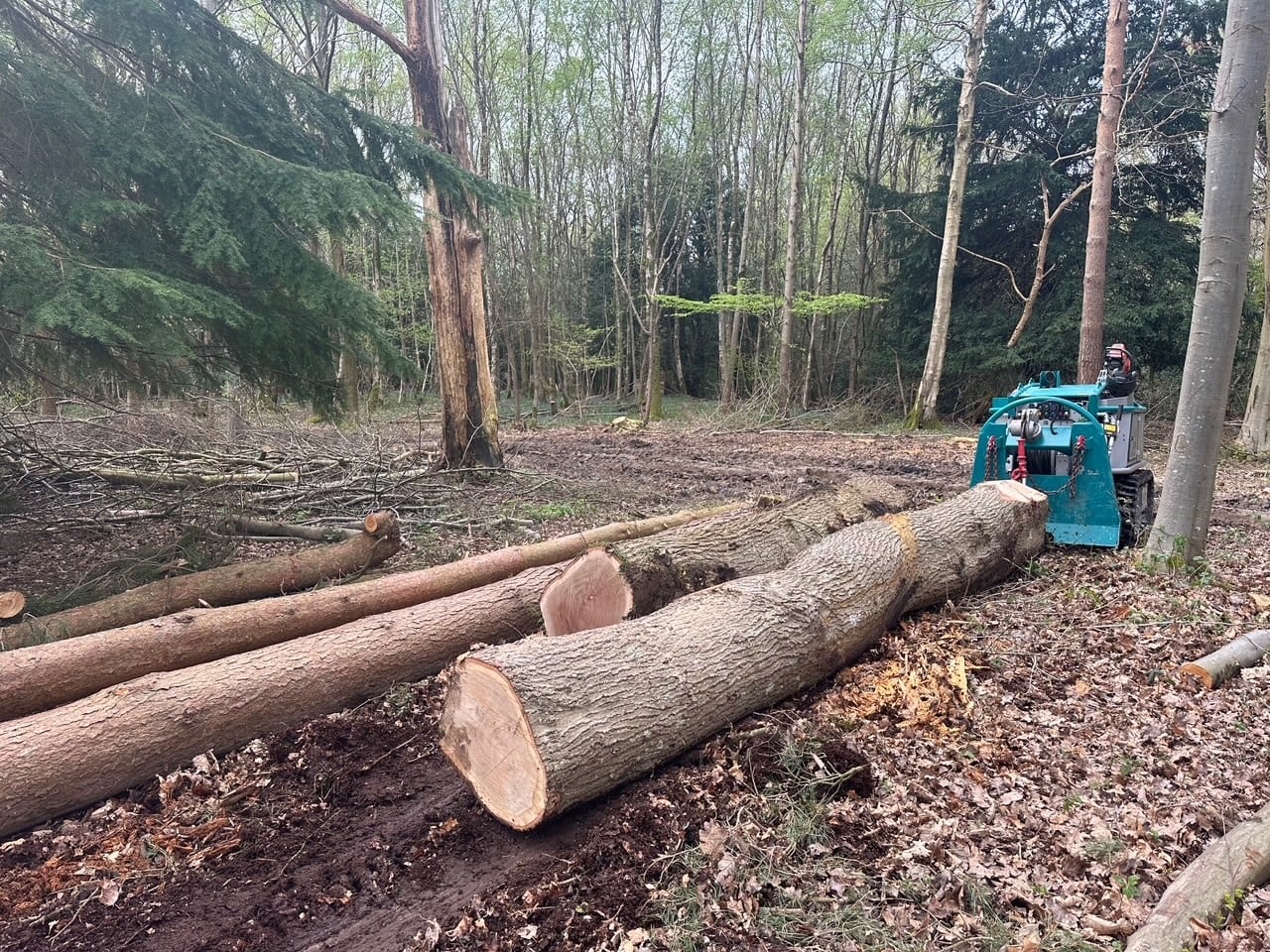
Standinghall Estate: specialist kit for High Weald woodland management
Managing woodlands in the High Weald's increasingly wet winters is a problem many landowners will recognise. A grant from FiPL has helped Effie and Darren Phizaklea to buy specialist kit to help protect vulnerable woodland soils on their estate at Standinghall. "Thanks to the FiPL grant we had been able to invest in equipment that works for us: it treads lightly, performs different tasks, reduces damage to the landscape and supports long-term woodland health."
Find out more
Local Nature Recovery Strategies
The recent publication of the Sussex Local Nature Recovery Strategies (LNRSs) means that every part of the High Weald National Landscape is now covered by an adopted Strategy. Find out more about county-level LNRSs, and how they complement the High Weald Management Plan.
Find out more
Reviving the High Weald’s Local Wildlife Sites
Through our new partnership project with Kent and Sussex Wildlife Trusts we are aiming to revive some of the High Weald’s most valuable Local Wildlife Sites. We will be working with site landowners across the landscape to offer free habitat surveys and to provide practical support for conservation management, including funding advice. The work will strengthen nature recovery across the High Weald while supporting the long-term stewardship of these precious sites.
Find out more